Log in
All resources
Create a design
962 Free Artworks of Maps America
island of california
bibliothèque nationale de france
lawrence h. slaughter collection of english maps, charts, globes, books and atlases
maps by willem and johannes blaeu
sanson maps of north america
maps by nicolas sanson
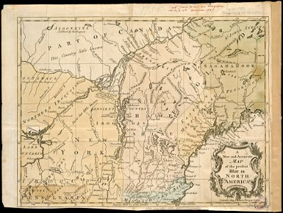
a map of the british empire in america with the french and spanish settlements adjacent thereto
university of texas at arlington
nypl lionel pincus and princess firyal map division
maps of north america
lawrence h. slaughter collection of english maps, charts, globes, books and atlases
nypl lionel pincus and princess firyal map division
art works by joaquín torres garcía
1943 in art
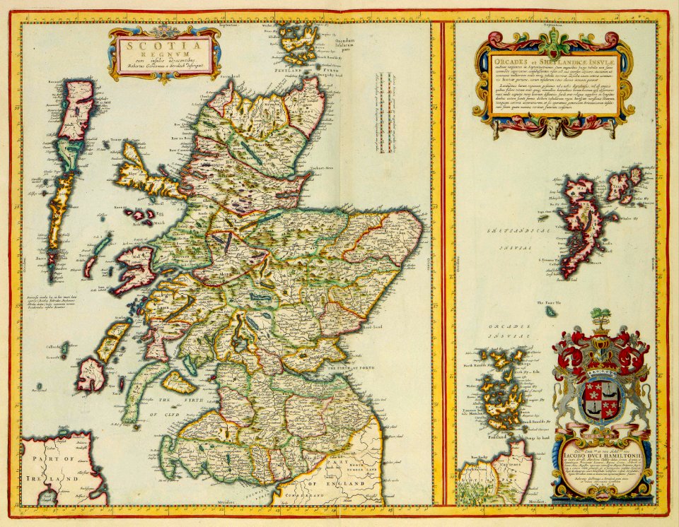
history of scotland
victorian era
1520s maps of the americas
1529 maps
americae 1562 by diego gutiérrez and hieronymus cock
renaissance
european exploration of africa
portuguese empire
18th-century maps of north america
1708 maps of north america
1560s maps of north america
paolo forlani
maps of the dutch east india company - australia
old maps of the dutch east india company
lawrence h. slaughter collection of english maps, charts, globes, books and atlases
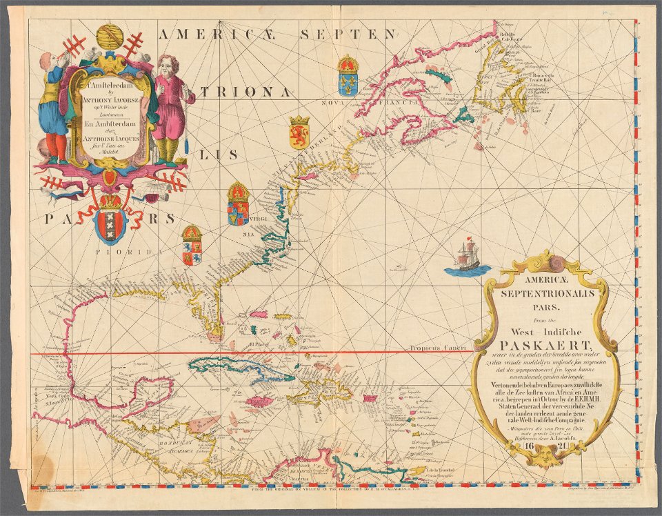
maps of nieuw nederland
old maps of the united states
copper engravings
1730s maps of south carolina
old maps of north america
1747 maps of north carolina
maps by emanuel bowen
robert wallis (engraver)
henry warren
alphabet charts
lord's prayer
1849 maps of north america
old maps of canada
americae 1562 by diego gutiérrez and hieronymus cock
renaissance
maps by jean-baptiste bourguignon d'anville
maps by thomas kitchin
old maps of the united states
sanson maps of north america
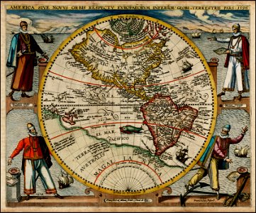
maps by willem and johannes blaeu
pantanal
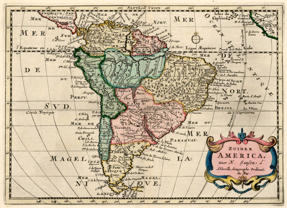
sanson maps of south america
1719 maps of south america
old maps of french guiana
1630s maps of brazil
synopsis universae philologiae
maps of continents
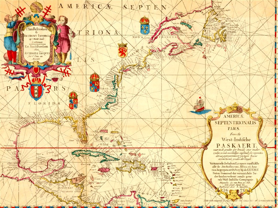
maps of the west-indische compagnie
1758 maps
1620s maps of north america
1620s maps of the caribbean
maps of america by guillaume delisle (18th century)
1760s maps of the americas
1850s maps of the americas
maps by john tallis
maps by alexis-hubert jaillot
maps by nicolas sanson
maps by willem and johannes blaeu
1660s maps of the americas
1740s maps of the caribbean
daniel de la feuille
17th-century maps of south america
maps by nicolas sanson
maps by emanuel bowen
robert sayer
1600s maps of north america
1600s maps of south america
cornell: persuasive cartography: the pj mode collection
maps of continents
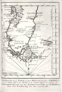
17th-century maps of the strait of magellan
1635 maps
old maps of the western hemisphere
jacob van meurs
1590s maps of brazil
animals on maps
synopsis universae philologiae
1741 maps of europe
1640s maps of the americas
maps by jodocus hondius
david rumsey historical map collection
andrew dury
1690s maps of the caribbean
1690s maps of the americas
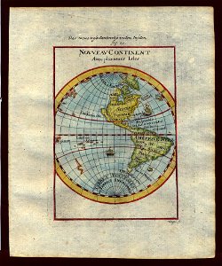
1520s maps of the world
propaganda map
lawrence h. slaughter collection of english maps, charts, globes, books and atlases
nypl lionel pincus and princess firyal map division
maps of the indigenous peoples of north america
renaissance
maps by guillaume delisle
philippe buache
incidents of travel in central america, chiapas, and yucatan (1841)
romanticism
maps by willem and johannes blaeu
1610s maps of the americas
maps made in the 16th century
theodor de bry
a map of the british empire in america with the french and spanish settlements adjacent thereto
1730s maps of the caribbean
media contributed by cleveland public library
georg widmann
lawrence h. slaughter collection of english maps, charts, globes, books and atlases
1640s maps of the americas
robert wallis (engraver)
henry warren
synopsis universae philologiae
1740s maps of the world
cartouches by willem and johannes blaeu
dutch-language maps
maps of ciudad colonial
caribbean sea in art
maps of the west-indische compagnie
1705
william henry toms
henry popple
lawrence h. slaughter collection of english maps, charts, globes, books and atlases
nypl lionel pincus and princess firyal map division
maps in the library of congress
1763 maps of north america
1790s maps of central america
1790s maps of cuba
maps of the war of the spanish succession
apalachee
sanson maps of north america
maps by nicolas sanson
sanson maps of north america
maps by nicolas sanson
sanson maps of north america
maps by nicolas sanson
sanson maps of north america
maps by nicolas sanson
theodor de bry
1594 maps
17th-century maps of the americas
island of california
curt teich postcard archives
map postcards
juan de la cruz cano y olmedilla
1755 maps of north america
sanson maps of north america
maps by nicolas sanson
lawrence h. slaughter collection of english maps, charts, globes, books and atlases
nypl lionel pincus and princess firyal map division
maps made in the 16th century
johannes ruysch
old maps of north america from the norman b. leventhal map center
1740 maps of north america
1620s maps of north america
1620s maps of the caribbean
1620s maps of north america
1620s maps of the caribbean
maps of south america by mercator-hondius
maps in the biblioteca nacional do brasil
1780s maps of florida
maps of florida
1770s maps of alaska
robert de vaugondy
juan de la cruz cano y olmedilla
maps by tomas lopez
juan de la cruz cano y olmedilla
maps by tomas lopez
maps of the west-indische compagnie
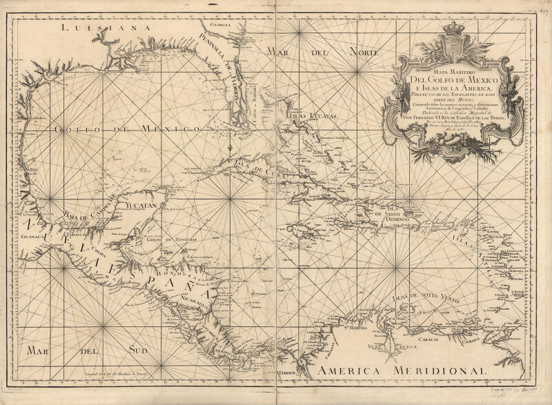
1757 maps of south america
lawrence h. slaughter collection of english maps, charts, globes, books and atlases
nypl lionel pincus and princess firyal map division
atlas maior, vol 12 (america) - joan blaeu, 1667 - bl 114.h(star).12
1667 maps
old maps of the united states from the norman b. leventhal map center
old maps of canada from the norman b. leventhal map center
1777 maps of south america
maps by thomas kitchin
maps in the library of congress
1768 maps of north america
a map of the british empire in america with the french and spanish settlements adjacent thereto
1730s maps of the caribbean
travels in the interior of north america, during the years 1832–1834
works by maximilian zu wied-neuwied
1810 maps of north america
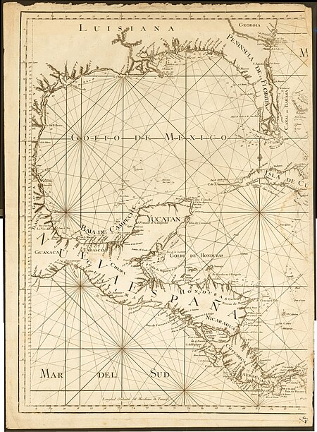
1810 maps of mexico
18th-century maps of havana
1730s maps of cuba
maps by willem and johannes blaeu
atlas van loon
maps from the mechanical curator collection
through the subarctic forest (1896) by pike
old maps of the western hemisphere
1710s maps of the world
picturesque journey to the two americas, asia and africa
lima in the 1840s
maps by willem and johannes blaeu
new amsterdam
maps by william home lizars
1836 maps of mexico
maps by william home lizars
1836 maps of mexico
maps in the library of congress
1750s maps of central america
maps from gallica
baroque
1720s maps of the caribbean
maps by pieter mortier
201 - 300 of 962
Next page
/ 10